
Thank you for supporting this site ❤️
Make a donation
Make a donation
Gear up for your next adventure:
As an Amazon Associate, this site earns from qualifying purchases at no extra cost to you.
Spork topographic map
Click on the map to display elevation.
Thank you for supporting this site ❤️
Make a donation
Make a donation
Gear up for your next adventure:
As an Amazon Associate, this site earns from qualifying purchases at no extra cost to you.
About this map
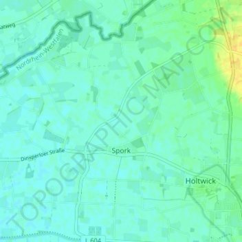
Name: Spork topographic map, elevation, terrain.
Location: Spork, Bocholt, Kreis Borken, Nordrhein-Westfalen, Deutschland (51.84778 6.52216 51.88818 6.57552)
Average elevation: 23 m
Minimum elevation: 18 m
Maximum elevation: 39 m
Thank you for supporting this site ❤️
Make a donation
Make a donation
Gear up for your next adventure:
As an Amazon Associate, this site earns from qualifying purchases at no extra cost to you.