
Thank you for supporting this site ❤️
Make a donation
Make a donation
Gear up for your next adventure:
As an Amazon Associate, this site earns from qualifying purchases at no extra cost to you.
Loser topographic map
Click on the map to display elevation.
Thank you for supporting this site ❤️
Make a donation
Make a donation
Gear up for your next adventure:
As an Amazon Associate, this site earns from qualifying purchases at no extra cost to you.
About this map
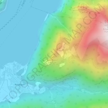
Name: Loser topographic map, elevation, terrain.
Location: Loser, Ebensee, Bezirk Gmunden, Upper Austria, 4802, Austria (47.81246 13.80547 47.81256 13.80557)
Average elevation: 709 m
Minimum elevation: 420 m
Maximum elevation: 1,521 m
Thank you for supporting this site ❤️
Make a donation
Make a donation
Gear up for your next adventure:
As an Amazon Associate, this site earns from qualifying purchases at no extra cost to you.