
Ōsumi Islands topographic map
Interactive map
Click on the map to display elevation.
About this map
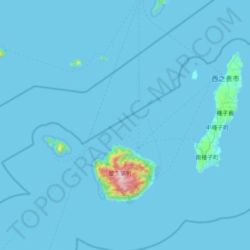
Name: Ōsumi Islands topographic map, elevation, terrain.
Location: Ōsumi Islands, Kumage County, Kagoshima Prefecture, Japan (30.22634 129.90435 30.85169 131.08339)
Average elevation: 29 m
Minimum elevation: 0 m
Maximum elevation: 1,881 m
The Ōsumi Islands are of volcanic origin and have a total area of approximately 1,030 square kilometres (400 sq mi). The highest elevation is Miyanouradake with a height of 1,935 metres (6,348 ft) on Yakushima. The climate is a humid subtropical climate (Köppen climate classification Cfa) with very warm summers and mild winters. Precipitation is high throughout the year, but is highest in the months of May, June and September.
Other topographic maps
Click on a map to view its topography, its elevation and its terrain.
Kuchinoerabu Island
Japan > Kumage County > Yakushima
Kuchinoerabu Island, Yakushima, Kumage County, Kagoshima Prefecture, Japan
Average elevation: 47 m