
Blieskastel topographic map
Interactive map
Click on the map to display elevation.
About this map
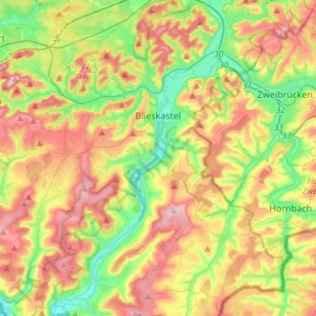
Name: Blieskastel topographic map, elevation, terrain.
Location: Blieskastel, Saarpfalz-Kreis, Sarre, 66440, Allemagne (49.12958 7.17816 49.29908 7.36896)
Average elevation: 294 m
Minimum elevation: 201 m
Maximum elevation: 409 m