Geolocate

Chanute topographic map

Click on the map to display elevation.

About this map

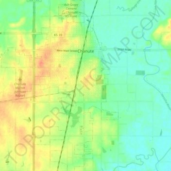
Name: Chanute topographic map, elevation, terrain.

Location: Chanute, Neosho County, Kansas, 66720, United States (37.63075 -95.49703 37.70316 -95.43436)

Average elevation: 287 m

Minimum elevation: 271 m

Maximum elevation: 309 m

Other topographic maps

Click on a map to view its topography, its elevation and its terrain.

Shaw

United States > Kansas > Neosho County

Average elevation: 276 m

Gear up for your next adventure:

🛠️Outdoor Repair Kits - Gear repair kits
🕶️Polarized Sunglasses - UV protection sunglasses for outdoors
🍳Ultralight Camping Stoves - Boil water quickly for meals using minimal fuel
🧺Fast-Dry Microfiber Towels - Large towels that pack down to the size of an orange
🧳Outdoor Travel Organizers - Gear organization accessories

As an Amazon Associate, this site earns from qualifying purchases at no extra cost to you.