
Kwale topographic map
Interactive map
Click on the map to display elevation.
About this map
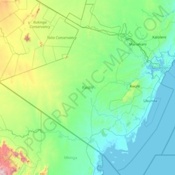
Name: Kwale topographic map, elevation, terrain.
Location: Kwale, Kenya (-4.79955 38.44879 -3.57197 39.73932)
Average elevation: 282 m
Minimum elevation: -1 m
Maximum elevation: 2,013 m
Other topographic maps
Click on a map to view its topography, its elevation and its terrain.