
Thank you for supporting this site ❤️
Make a donation
Make a donation
Gear up for your next adventure:
As an Amazon Associate, this site earns from qualifying purchases at no extra cost to you.
Luppenau topographic map
Click on the map to display elevation.
Thank you for supporting this site ❤️
Make a donation
Make a donation
Gear up for your next adventure:
As an Amazon Associate, this site earns from qualifying purchases at no extra cost to you.
About this map
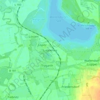
Name: Luppenau topographic map, elevation, terrain.
Location: Luppenau, Schkopau, Saalekreis, Saxony-Anhalt, 06258, Germany (51.34670 12.03000 51.38670 12.07000)
Average elevation: 86 m
Minimum elevation: 77 m
Maximum elevation: 106 m
Thank you for supporting this site ❤️
Make a donation
Make a donation
Gear up for your next adventure:
As an Amazon Associate, this site earns from qualifying purchases at no extra cost to you.