Geolocate

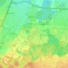
Feldkirchen topographic map

Click on the map to display elevation.

About this map
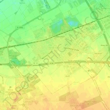
Name: Feldkirchen topographic map, elevation, terrain.

Location: Feldkirchen, Landkreis München, Bavaria, 85622, Germany (48.13266 11.70505 48.15770 11.75798)

Average elevation: 525 m

Minimum elevation: 505 m

Maximum elevation: 536 m

Other topographic maps

Click on a map to view its topography, its elevation and its terrain.
Eglfing

Germany > Bavaria > Landkreis München > Haar

Average elevation: 540 m

Martinsried

Germany > Bavaria > Landkreis München > Planegg

Average elevation: 549 m

Hofolding

Germany > Bavaria > Landkreis München

Average elevation: 609 m

Holzhausen

Germany > Bavaria > Landkreis München

Average elevation: 663 m

Deisenhofen

Germany > Bavaria > Landkreis München > Oberhaching

Average elevation: 592 m

Gear up for your next adventure:

🎒Dry Bags - Waterproof bags for outdoor gear
📍Handheld GPS - GPS devices for hiking and navigation
📦Crushproof Equipment Cases - Safe transport for sensitive surveying and mapping instruments
📡Satellite Messengers - Emergency communication devices
🪫Rechargeable Headlamps - USB rechargeable headlamps

As an Amazon Associate, this site earns from qualifying purchases at no extra cost to you.