
청계천 topographic map
Interactive map
Click on the map to display elevation.
About this map
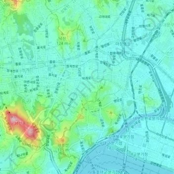
Name: 청계천 topographic map, elevation, terrain.
Location: 청계천, 황학동, 중구, Séoul, 04521, Corée du Sud (37.55269 126.97839 37.57236 127.05219)
Average elevation: 45 m
Minimum elevation: 2 m
Maximum elevation: 265 m