

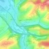
Spechbach topographic map
Click on the map to display elevation.
Spechbach
Spechbach is located on the border between the Kleiner Odenwald and Kraichgau, 21 km southeast of Heidelberg, between Heidelberg, Sinsheim and Mosbach. The district of Spechbach essentially comprises the Spechbachtal of the same name as well as the ridges on both sides and lies at an altitude of about 160 to 330 meters.
About this map

Name: Spechbach topographic map, elevation, terrain.
Average elevation: 221 m
Minimum elevation: 158 m
Maximum elevation: 336 m
Other topographic maps
Click on a map to view its topography, its elevation and its terrain.
Sinsheim-Steinsfurt / Insenbach
Germany > Baden-Württemberg > Rhein-Neckar-Kreis > Sinsheim
Average elevation: 204 m