Geolocate

Pugu topographic map

Click on the map to display elevation.

About this map
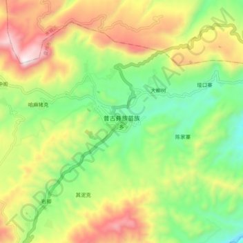
Name: Pugu topographic map, elevation, terrain.

Location: Pugu, Liupanshui, Guizhou, China (26.01966 104.70258 26.09966 104.78258)

Average elevation: 1,927 m

Minimum elevation: 1,497 m

Maximum elevation: 2,523 m

Gear up for your next adventure:

🦶Orthotic Hiking Insoles - Extra arch support for long-distance topographic treks
🧥Down Jackets - Insulated jackets for cold weather
💡Collapsible Camping Lanterns - Illuminate your base camp or tent for map studying at night
📟Satellite Messengers - Two-way satellite communication to stay in touch beyond the cellular grid
🧊Insulated Cooler Bags - Keep food fresh for day trips to remote geographic sites

As an Amazon Associate, this site earns from qualifying purchases at no extra cost to you.