Geolocate

Tekirdağ topographic map

Click on the map to display elevation.

About this map
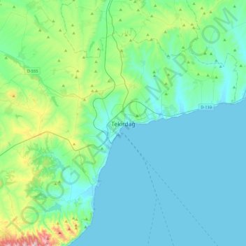
Name: Tekirdağ topographic map, elevation, terrain.

Location: Tekirdağ, Süleymanpaşa, Tekirdağ, Marmara Region, 59200, Turkey (40.81812 27.35078 41.13812 27.67078)

Average elevation: 109 m

Minimum elevation: -1 m

Maximum elevation: 708 m

Other topographic maps

Click on a map to view its topography, its elevation and its terrain.

Husunlu Mahallesi

Turkey > Süleymanpaşa

Average elevation: 105 m

Gear up for your next adventure:

🦯Trekking Poles - Walking poles for hiking stability
📍Handheld GPS - GPS devices for hiking and navigation
🧯Animal Deterrent Spray - Safety spray for wildlife
🥾Trail Running Shoes - Shoes for trail running
🦯Adjustable Trekking Poles - Reduce impact on knees when descending steep topographic ridges

As an Amazon Associate, this site earns from qualifying purchases at no extra cost to you.