Geolocate

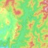
Verdivia Falls topographic map

Click on the map to display elevation.

About this map

Name: Verdivia Falls topographic map, elevation, terrain.

Location: Verdivia Falls, Doña Remedios Trinidad, Bulacan, Central Luzon, Philippines (15.09935 121.11328 15.09945 121.11338)

Average elevation: 203 m

Minimum elevation: 114 m

Maximum elevation: 336 m

Other topographic maps

Click on a map to view its topography, its elevation and its terrain.
Gear up for your next adventure:

🔥Camping Stoves - Portable stoves for outdoor cooking
📦Crushproof Equipment Cases - Safe transport for sensitive surveying and mapping instruments
🧤Thermal Hiking Gloves - Keep your hands warm and functional during high-altitude winter treks
📍Handheld GPS - GPS devices for hiking and navigation
👟Lightweight Trail Runners - Agile footwear for fast movement over rugged Australian terrain

As an Amazon Associate, this site earns from qualifying purchases at no extra cost to you.