Geolocate

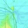
Kofa Butte topographic map

Click on the map to display elevation.

About this map

Name: Kofa Butte topographic map, elevation, terrain.

Location: Kofa Butte, Yuma County, Arizona, United States (33.27721 -113.92943 33.27731 -113.92933)

Average elevation: 687 m

Minimum elevation: 517 m

Maximum elevation: 984 m

Other topographic maps

Click on a map to view its topography, its elevation and its terrain.

Wellton

United States > Arizona > Yuma County

Average elevation: 97 m

San Luis

United States > Arizona > Yuma County

Average elevation: 36 m

Dateland

United States > Arizona > Yuma County

Average elevation: 134 m

Fortuna Foothills

United States > Arizona > Yuma County > Yuma

Average elevation: 133 m

Yuma

United States > Arizona > Yuma County

Average elevation: 56 m

Mittry Lake

United States > Arizona > Yuma County > Laguna

Average elevation: 58 m

Combat Village

United States > Arizona > Yuma County

Average elevation: 286 m

Yuma

United States > Arizona > Yuma County

Average elevation: 56 m

Dateland

United States > Arizona > Yuma County

Average elevation: 134 m

Yuma

United States > Arizona > Yuma County

Average elevation: 56 m

Somerton

United States > Arizona > Yuma County

Average elevation: 33 m

Yuma

United States > Arizona > Yuma County

Average elevation: 56 m

Gear up for your next adventure:

🦯Adjustable Trekking Poles - Reduce impact on knees when descending steep topographic ridges
🎽Hiking Clothing - Breathable clothing for hiking
☕Outdoor Coffee Makers - Enjoy quality coffee at the summit of your favorite peak
🦶Orthotic Hiking Insoles - Extra arch support for long-distance topographic treks
🦟Insect Repellent - Protection against insects

As an Amazon Associate, this site earns from qualifying purchases at no extra cost to you.