Geolocate

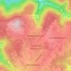
Billigheim topographic map

Click on the map to display elevation.

About this map

Name: Billigheim topographic map, elevation, terrain.

Location: Billigheim, GVV Schefflenztal, Neckar-Odenwald-Kreis, Baden-Württemberg, 74842, Germany (49.29739 9.17867 49.38170 9.31531)

Average elevation: 291 m

Minimum elevation: 165 m

Maximum elevation: 364 m

Other topographic maps

Click on a map to view its topography, its elevation and its terrain.
Gear up for your next adventure:

🧴Sunscreen SPF - Sun protection for outdoor activities
👄SPF Lip Balm - Prevent sun and wind-burnt lips on mountain ridges
🧣Merino Neck Gaiters - Versatile headwear for warmth, sun protection, or dust filtering
👕UPF 50+ Sun Shirts - Essential protection against the harsh Australian sun during field work
🧤Hiking Gloves - Protective gloves for outdoor use

As an Amazon Associate, this site earns from qualifying purchases at no extra cost to you.