Geolocate

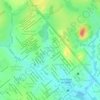
Paraná topographic map

Click on the map to display elevation.

About this map

Name: Paraná topographic map, elevation, terrain.

Location: Paraná, Ouro Preto do Oeste, Região Geográfica Imediata de Ji-Paraná, Região Geográfica Intermediária de Ji-Paraná, Rondônia, Região Norte, Brasil (-10.63377 -62.33643 -10.59377 -62.29643)

Average elevation: 212 m

Minimum elevation: 186 m

Maximum elevation: 262 m

Other topographic maps

Click on a map to view its topography, its elevation and its terrain.
Rondominas

Brasil > Rondônia > Ouro Preto do Oeste

Average elevation: 178 m

Incra

Brasil > Rondônia > Ouro Preto do Oeste

Average elevation: 256 m

Gear up for your next adventure:

🧤Hiking Gloves - Protective gloves for outdoor use
🍳Camping Cookware - Cookware sets for outdoor meals
🥾Trail Running Shoes - Shoes for trail running
🌿Flora and Fauna Field Guides - Identify the plants and animals you encounter on your route
🧥Packable Rain Jackets - Breathable waterproof layers for unpredictable mountain weather

As an Amazon Associate, this site earns from qualifying purchases at no extra cost to you.