Geolocate

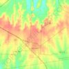
Monkstown topographic map

Click on the map to display elevation.

About this map

Name: Monkstown topographic map, elevation, terrain.

Location: Monkstown, Fannin County, Texas, United States (33.77318 -95.94797 33.81318 -95.90797)

Average elevation: 151 m

Minimum elevation: 146 m

Maximum elevation: 171 m

Other topographic maps

Click on a map to view its topography, its elevation and its terrain.

Bonham

United States > Texas > Fannin County

Average elevation: 184 m

Leonard

United States > Texas > Fannin County

Average elevation: 210 m

Ladonia

United States > Texas > Fannin County

Average elevation: 178 m

Bonham

United States > Texas > Fannin County

Average elevation: 184 m

Indian Creek

United States > Texas > Fannin County > Trenton

Average elevation: 217 m

Honey Grove

United States > Texas > Fannin County

Honey Grove is in central North Texas, in eastern Fannin County, 16 miles (26 km) east of Bonham, the county seat, 39 miles (63 km) north of Greenville, 42 miles (68 km) east of Sherman, and 90 miles (140 km) northeast of the central business district of Dallas. Honey Grove was developed on flat to gently…

Average elevation: 195 m

Ravenna

United States > Texas > Fannin County

Average elevation: 179 m

Leonard

United States > Texas > Fannin County

Average elevation: 210 m

Gear up for your next adventure:

🧺Waterproof Dry Sacks - Organize your pack and keep electronics safe from rain and river crossings
📕Australia Maps - Maps covering Australian regions
🩹Wilderness First Aid Kits - Comprehensive medical kits tailored for hiking and remote exploration
📡Portable Emergency Radios - Stay informed about weather warnings and bushfire alerts
☕Outdoor Coffee Makers - Enjoy quality coffee at the summit of your favorite peak

As an Amazon Associate, this site earns from qualifying purchases at no extra cost to you.