

Surat topographic map
Click on the map to display elevation.
Surat
Surat is a port city situated on the banks of the Tapi river. Damming of the Tapi caused the original port facilities to close; the nearest port is now in the Magadalla and Hazira area of Surat Metropolitan Region.It has famous beach called 'Dumas Beach' located in Hazira. The city is located at 21°10′N 72°50′E / 21.17°N 72.83°E / 21.17; 72.83. It has an average elevation of 13 metres. The Surat district is surrounded by the Bharuch, Narmada, Navsari, to the west is the Gulf of Cambay and the surrounding districts. The climate is tropical and monsoon rainfall is abundant (about 2,500 mm a year). According to the Bureau of Indian Standards, the town falls under seismic zone-III, in a scale of I to V (in order of increasing vulnerability to earthquakes).
About this map
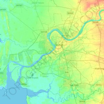
Name: Surat topographic map, elevation, terrain.
Location: Surat, Katargam Taluka, Surat, Gujarat, 395001, India (21.02646 72.64813 21.34646 72.96813)
Average elevation: 11 m
Minimum elevation: -3 m
Maximum elevation: 33 m