
Mary Cove topographic map
Interactive map
Click on the map to display elevation.
About this map
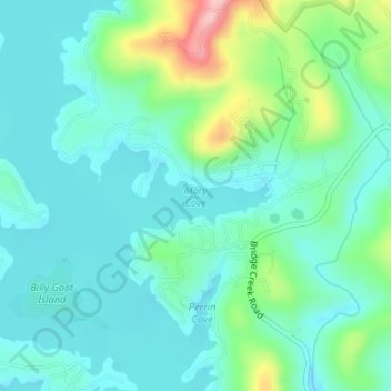
Name: Mary Cove topographic map, elevation, terrain.
Location: Mary Cove, Rabun County, Georgia, United States (34.81282 -83.54244 34.81292 -83.54234)
Average elevation: 602 m
Minimum elevation: 563 m
Maximum elevation: 732 m