
Thank you for supporting this site ❤️
Make a donation
Make a donation
Gear up for your next adventure:
As an Amazon Associate, this site earns from qualifying purchases at no extra cost to you.
Chahorra topographic map
Click on the map to display elevation.
Thank you for supporting this site ❤️
Make a donation
Make a donation
Gear up for your next adventure:
As an Amazon Associate, this site earns from qualifying purchases at no extra cost to you.
About this map
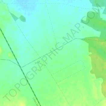
Name: Chahorra topographic map, elevation, terrain.
Location: Chahorra, Palacios de Goda, Ávila, Castilla y León, España (41.13601 -4.76652 41.15601 -4.74652)
Average elevation: 794 m
Minimum elevation: 787 m
Maximum elevation: 803 m
Thank you for supporting this site ❤️
Make a donation
Make a donation
Gear up for your next adventure:
As an Amazon Associate, this site earns from qualifying purchases at no extra cost to you.