Geolocate

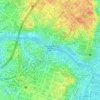
Poblacion topographic map

Click on the map to display elevation.

About this map

Name: Poblacion topographic map, elevation, terrain.

Location: Poblacion, District I, Makati, Southern Manila District, Metropolitan Manila, 1210, Philippines (14.56160 121.02356 14.57359 121.03902)

Average elevation: 15 m

Minimum elevation: 1 m

Maximum elevation: 59 m

Other topographic maps

Click on a map to view its topography, its elevation and its terrain.

Magallanes

Philippines > Makati

Average elevation: 12 m

Makati Park

Philippines > Makati

Average elevation: 24 m

Salcedo Park

Philippines > Makati

Average elevation: 15 m

Kennely Ann L. Binay Park

Philippines > Makati

Average elevation: 22 m

Ayala Triangle Gardens

Philippines > Makati

Average elevation: 17 m

Washington SyCip Park

Philippines > Makati

Average elevation: 15 m

Ayala Triangle Gardens

Philippines > Makati

Average elevation: 17 m

Plaza Cristo Rey

Philippines > Makati

Average elevation: 15 m

Gear up for your next adventure:

🏕️Camping Gear - Essential camping equipment
🔌Fast Charging Adapters - Quickly top up all your gear before heading back into the field
🍴Titanium Spork & Cutlery - Indestructible and feather-light eating utensils
🧥Insulated Down Jackets - High warmth-to-weight ratio for cold nights in the high country
⌚Altimeter Watches - Watches with altitude tracking

As an Amazon Associate, this site earns from qualifying purchases at no extra cost to you.