
Thank you for supporting this site ❤️
Make a donation
Make a donation
Gear up for your next adventure:
As an Amazon Associate, this site earns from qualifying purchases at no extra cost to you.
Pueblo topographic map
Click on the map to display elevation.
Thank you for supporting this site ❤️
Make a donation
Make a donation
Gear up for your next adventure:
As an Amazon Associate, this site earns from qualifying purchases at no extra cost to you.
About this map
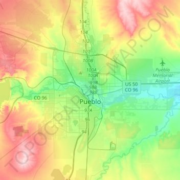
Name: Pueblo topographic map, elevation, terrain.
Location: Pueblo, Pueblo County, Colorado, United States (38.18911 -104.72227 38.34537 -104.46004)
Average elevation: 1,487 m
Minimum elevation: 1,393 m
Maximum elevation: 1,629 m
Thank you for supporting this site ❤️
Make a donation
Make a donation
Gear up for your next adventure:
As an Amazon Associate, this site earns from qualifying purchases at no extra cost to you.