
Morel topographic map
Interactive map
Click on the map to display elevation.
About this map
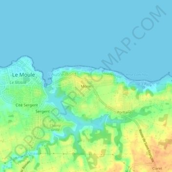
Name: Morel topographic map, elevation, terrain.
Location: Morel, Le Moule, Pointe-à-Pitre, Guadeloupe, 97160, France (16.30897 -61.35245 16.34897 -61.31245)
Average elevation: 10 m
Minimum elevation: -4 m
Maximum elevation: 36 m