
Make a donation
Gear up for your next adventure:
As an Amazon Associate, this site earns from qualifying purchases at no extra cost to you.
Methana topographic map
Click on the map to display elevation.
Make a donation
Gear up for your next adventure:
As an Amazon Associate, this site earns from qualifying purchases at no extra cost to you.
Methana
Since 1991, the peninsula has been investigated by the team of ETH Zürich geologically and cartographically. From this, a topographical map of the entire peninsula at a scale of 1:25,000 was made. An interactive 3D map was created and is on the World Wide Web. Also a rich photographic archive with about 10.000 color slides has been produced (see links below).
Make a donation
Gear up for your next adventure:
As an Amazon Associate, this site earns from qualifying purchases at no extra cost to you.
About this map
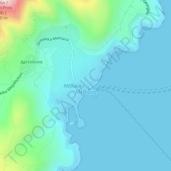
Name: Methana topographic map, elevation, terrain.
Average elevation: 99 m
Minimum elevation: -2 m
Maximum elevation: 568 m
Make a donation
Gear up for your next adventure:
As an Amazon Associate, this site earns from qualifying purchases at no extra cost to you.