
Fatsa topographic map
Interactive map
Click on the map to display elevation.
About this map
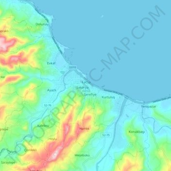
Name: Fatsa topographic map, elevation, terrain.
Location: Fatsa, Ordu, Región del Mar Negro, 52400, Turquía (40.98918 37.45985 41.06918 37.53985)
Average elevation: 62 m
Minimum elevation: 0 m
Maximum elevation: 330 m