Geolocate

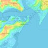
Manningtree topographic map

Click on the map to display elevation.

About this map

Name: Manningtree topographic map, elevation, terrain.

Location: Manningtree, Tendring, Essex, England, United Kingdom (51.94285 1.05841 51.94914 1.06743)

Average elevation: 13 m

Minimum elevation: -4 m

Maximum elevation: 39 m

Other topographic maps

Click on a map to view its topography, its elevation and its terrain.
Clacton-on-Sea

United Kingdom > England > Essex > Tendring

Average elevation: 7 m

Dovercourt

United Kingdom > England > Essex > Tendring

Average elevation: 4 m

Walton-on-the-Naze

United Kingdom > England > Essex > Tendring

Average elevation: 3 m

Frinton-on-Sea

United Kingdom > England > Essex > Tendring

Average elevation: 5 m

Frinton-on-Sea

United Kingdom > England > Essex > Tendring

Average elevation: 5 m

Dovercourt

United Kingdom > England > Essex > Tendring

Average elevation: 4 m

Clacton-on-Sea

United Kingdom > England > Essex > Tendring

Average elevation: 7 m

Clacton-on-Sea

United Kingdom > England > Essex > Tendring

Average elevation: 7 m

Gear up for your next adventure:

🛌Compact Down Sleeping Bags - Warmth without the bulk, ideal for backcountry camping
📚Map Reading & Navigation Guides - Master the art of interpreting topographic contours and symbols
👟Lightweight Trail Runners - Agile footwear for fast movement over rugged Australian terrain
🔥Windproof Plasma Lighters - USB rechargeable lighters that work in high-altitude winds
🐍Snake Gaiters - Protection against snake bites

As an Amazon Associate, this site earns from qualifying purchases at no extra cost to you.