
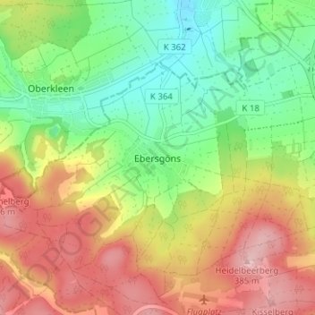
Ebersgöns topographic map
Interactive map
Click on the map to display elevation.
About this map
Name: Ebersgöns topographic map, elevation, terrain.
Location: Ebersgöns, Butzbach, Wetteraukreis, Hessen, 35428, Deutschland (50.43347 8.59071 50.47347 8.63071)
Average elevation: 287 m
Minimum elevation: 204 m
Maximum elevation: 386 m
Bodenrod | Ebersgöns | Fauerbach vor der Höhe | Griedel | Hausen-Oes | Hoch-Weisel | Kirch-Göns | Maibach | Münster | Nieder-Weisel | Ostheim | Pohl-Göns | Wiesental