
Papayal topographic map
Interactive map
Click on the map to display elevation.
About this map
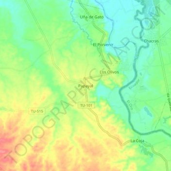
Name: Papayal topographic map, elevation, terrain.
Location: Papayal, Provincia de Zarumilla, Tumbes, Perú (-3.61136 -80.27458 -3.53136 -80.19458)
Average elevation: 39 m
Minimum elevation: 10 m
Maximum elevation: 83 m