
青铜峡市 topographic map
Interactive map
Click on the map to display elevation.
About this map
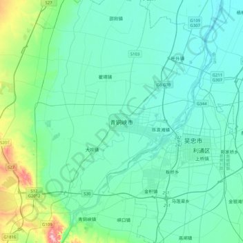
Name: 青铜峡市 topographic map, elevation, terrain.
Location: 青铜峡市, 裕民街道, 青铜峡市, 吴忠市, 宁夏回族自治区, 中国 (37.86117 105.91426 38.18117 106.23426)
Average elevation: 1,142 m
Minimum elevation: 1,108 m
Maximum elevation: 1,346 m