Geolocate

Ormana topographic map

Click on the map to display elevation.

About this map

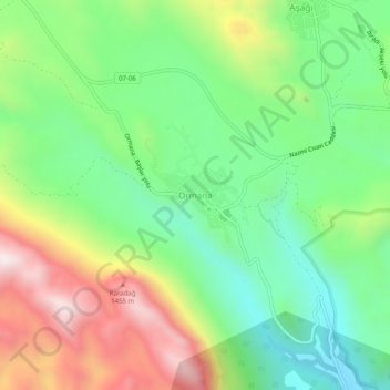
Name: Ormana topographic map, elevation, terrain.

Location: Ormana, İbradi, Antalya, Mediterranean Region, Turkey (37.05500 31.56095 37.09500 31.60095)

Average elevation: 1,071 m

Minimum elevation: 746 m

Maximum elevation: 1,597 m

Gear up for your next adventure:

🎒Hiking Backpacks - Backpacks designed for hiking and trekking
🌿Flora and Fauna Field Guides - Identify the plants and animals you encounter on your route
🩹Wilderness First Aid Kits - Comprehensive medical kits tailored for hiking and remote exploration
Lightweight Tents - Compact tents for backpacking
🏫Topographic World Globes - 3D physical relief globes to understand global geography

As an Amazon Associate, this site earns from qualifying purchases at no extra cost to you.