
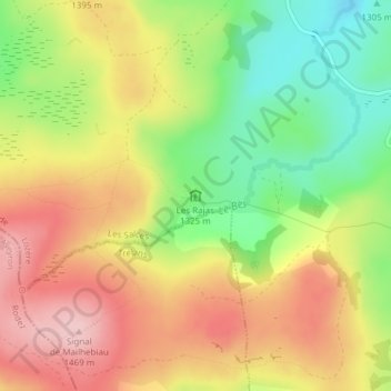
Les Rajas topographic map
Interactive map
Click on the map to display elevation.
About this map
Name: Les Rajas topographic map, elevation, terrain.
Average elevation: 1,370 m
Minimum elevation: 1,264 m
Maximum elevation: 1,468 m
Other topographic maps
Click on a map to view its topography, its elevation and its terrain.
Le Fromental
France > Occitanie > Lozère > Les Salces
Le Fromental, Les Salces, Mende, Lozère, Occitanie, France métropolitaine, 48100, France
Average elevation: 1,158 m
Cascade du Saltou
France > Occitanie > Lozère > Les Salces
Cascade du Saltou, Les Salces, Mende, Lozère, Occitanie, France métropolitaine, 48100, France
Average elevation: 1,332 m