
Reservorio topographic map
Interactive map
Click on the map to display elevation.
About this map
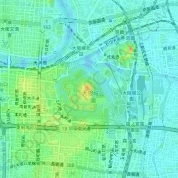
Name: Reservorio topographic map, elevation, terrain.
Location: Reservorio, 城見一丁目, 中央区, Osaka, Prefectura de Osaka, Japón (34.68681 135.52620 34.68768 135.52691)
Average elevation: 13 m
Minimum elevation: -4 m
Maximum elevation: 51 m