Geolocate

Brunswick Junction topographic map

Click on the map to display elevation.

About this map
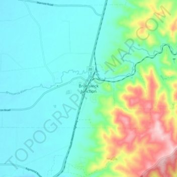
Name: Brunswick Junction topographic map, elevation, terrain.

Location: Brunswick Junction, Shire Of Harvey, Western Australia, Australia (-33.29595 115.80041 -33.21595 115.88041)

Average elevation: 76 m

Minimum elevation: 10 m

Maximum elevation: 281 m

Western Australia trails, hiking, mountain biking, running and outdoor activities

Gear up for your next adventure:

🖼️Scratch-off Australia Map - Track the regions and peaks you have explored geographically
🎨Portable Watercolor Kits - Paint the landscapes and topographic views you discover
🥤Outdoor Water Bottles - Reusable bottles for outdoor activities
🕶️Polarized Outdoor Sunglasses - Reduce glare from rocks and water for better visual navigation
🪫Rechargeable Headlamps - USB rechargeable headlamps

As an Amazon Associate, this site earns from qualifying purchases at no extra cost to you.