Geolocate

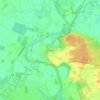
Papenburg topographic map

Click on the map to display elevation.

About this map

Name: Papenburg topographic map, elevation, terrain.

Location: Papenburg, Landkreis Emsland, Lower Saxony, 26871, Germany (53.00600 7.29102 53.11271 7.52466)

Average elevation: 5 m

Minimum elevation: -4 m

Maximum elevation: 13 m

Other topographic maps

Click on a map to view its topography, its elevation and its terrain.
Elbergen

Germany > Lower Saxony > Landkreis Emsland

Average elevation: 28 m

Mühlenmoor

Germany > Lower Saxony > Landkreis Emsland > Meppen > Helte

Average elevation: 17 m

Emen

Germany > Lower Saxony > Landkreis Emsland > Haren (Ems)

Average elevation: 13 m

Gear up for your next adventure:

☀️Portable Solar Chargers - High-efficiency panels to hang on your backpack while walking
🆘Personal Locator Beacons (PLB) - Satellite emergency beacons for life-saving help in areas with no mobile coverage
🔑Heavy Duty Carabiners - Secure gear to the outside of your pack for easy access
🩹Blister Prevention Tape - Apply to friction points before they become painful sores
🌿Flora and Fauna Field Guides - Identify the plants and animals you encounter on your route

As an Amazon Associate, this site earns from qualifying purchases at no extra cost to you.