
Kent topographic map
Click on the map to display elevation.
About this map
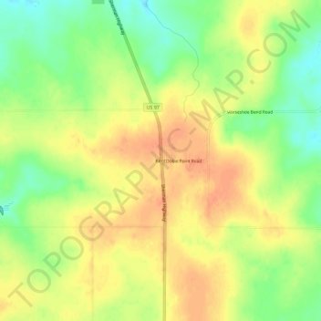
Name: Kent topographic map, elevation, terrain.
Location: Kent, Sherman County, Oregon, 97033, United States (45.17364 -120.71606 45.21364 -120.67606)
Average elevation: 811 m
Minimum elevation: 786 m
Maximum elevation: 829 m
Other topographic maps
Click on a map to view its topography, its elevation and its terrain.