Geolocate

Fauquier topographic map

Click on the map to display elevation.

About this map
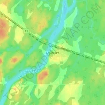
Name: Fauquier topographic map, elevation, terrain.

Location: Fauquier, Fauquier-Strickland Township, Cochrane District, Northeastern Ontario, Ontario, Canada (49.29016 -82.06023 49.33016 -82.02023)

Average elevation: 225 m

Minimum elevation: 210 m

Maximum elevation: 245 m

Other topographic maps

Click on a map to view its topography, its elevation and its terrain.
Gear up for your next adventure:

🧥Packable Rain Jackets - Breathable waterproof layers for unpredictable mountain weather
🧣Merino Neck Gaiters - Versatile headwear for warmth, sun protection, or dust filtering
🔋Solar Power Banks - Charge your phone and GPS using the sun while deep in the bush
🪢Paracord - Multi-purpose survival cord
🔪Multitools - Compact tools for outdoor use

As an Amazon Associate, this site earns from qualifying purchases at no extra cost to you.