Geolocate

Barnard topographic map

Click on the map to display elevation.

About this map

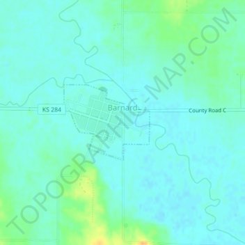
Name: Barnard topographic map, elevation, terrain.

Location: Barnard, Lincoln County, Kansas, 67418, United States (39.18475 -98.05034 39.19306 -98.03812)

Average elevation: 406 m

Minimum elevation: 399 m

Maximum elevation: 429 m

Gear up for your next adventure:

🌧️Rain Jackets - Waterproof jackets for hiking
🧺Fast-Dry Microfiber Towels - Large towels that pack down to the size of an orange
🚴Cycling Backpacks - Backpacks for cyclists
👣Snake & Scrub Gaiters - Protection against spinifex, mud, and snakes while walking off-track
🩹Blister Prevention Tape - Apply to friction points before they become painful sores

As an Amazon Associate, this site earns from qualifying purchases at no extra cost to you.