
Maas topographic map
Interactive map
Click on the map to display elevation.
About this map
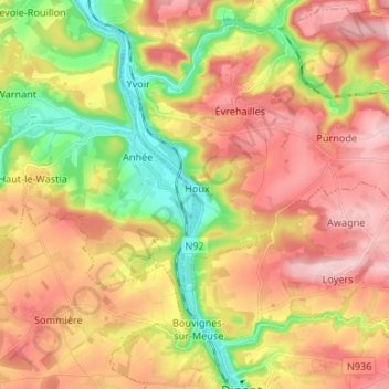
Name: Maas topographic map, elevation, terrain.
Location: Maas, Bouvignes-sur-Meuse, Dinant, Namen, Wallonië, België (50.25936 4.85636 50.34419 4.91227)
Average elevation: 194 m
Minimum elevation: 80 m
Maximum elevation: 294 m