
Tandjung Puting topographic map
Interactive map
Click on the map to display elevation.
About this map
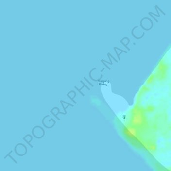
Name: Tandjung Puting topographic map, elevation, terrain.
Location: Tandjung Puting, Zentral-Kalimantan, Indonesien (-3.50357 111.76732 -3.50347 111.76742)
Average elevation: 1 m
Minimum elevation: 0 m
Maximum elevation: 13 m
Other topographic maps
Click on a map to view its topography, its elevation and its terrain.
Zentral-Kalimantan
Indonesien > Zentral-Kalimantan
Zentral-Kalimantan, Indonesien
Average elevation: 144 m
Palangka Raya
Indonesien > Zentral-Kalimantan > Palangka Raya
Palangka Raya, Zentral-Kalimantan, 73112, Indonesien
Average elevation: 10 m