Geolocate

Ferris topographic map

Click on the map to display elevation.

About this map

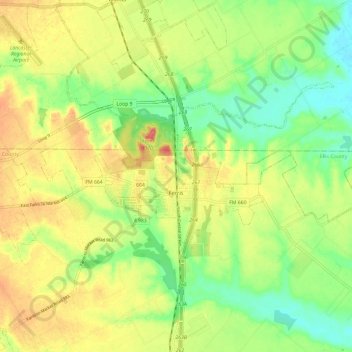
Name: Ferris topographic map, elevation, terrain.

Location: Ferris, Ellis County, Texas, United States (32.51975 -96.71296 32.55761 -96.59442)

Average elevation: 137 m

Minimum elevation: 107 m

Maximum elevation: 169 m

Other topographic maps

Click on a map to view its topography, its elevation and its terrain.

Alsdorf

United States > Texas > Ellis County

Average elevation: 119 m

Bristol

United States > Texas > Ellis County

Average elevation: 139 m

Gear up for your next adventure:

🔪Multitools - Compact tools for outdoor use
🦟Insect Repellent - Protection against insects
🏃Compression Recovery Socks - Reduce leg fatigue after heavy days of elevation gain
🧥Softshell Jackets - Flexible outdoor jackets
🧥Insulated Down Jackets - High warmth-to-weight ratio for cold nights in the high country

As an Amazon Associate, this site earns from qualifying purchases at no extra cost to you.