Geolocate

Simaron topographic map

Click on the map to display elevation.

About this map

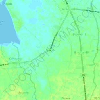
Name: Simaron topographic map, elevation, terrain.

Location: Simaron, Bayanan II, Oriental Mindoro, Mimaropa, Philippines (13.34060 121.13670 13.38060 121.17670)

Average elevation: 6 m

Minimum elevation: 0 m

Maximum elevation: 12 m

Gear up for your next adventure:

🧥Insulated Down Jackets - High warmth-to-weight ratio for cold nights in the high country
🧭Military Style Lensatic Compass - Durable sighting compasses for advanced land navigation and surveying
Ultralight Solo Tents - Compact shelters for multi-day topographic surveying expeditions
🚁Camera Drones with GPS - Capture aerial views of the landscape to compare with topo maps
🔌Fast Charging Adapters - Quickly top up all your gear before heading back into the field

As an Amazon Associate, this site earns from qualifying purchases at no extra cost to you.