
Orangevale topographic map
Interactive map
Click on the map to display elevation.
About this map
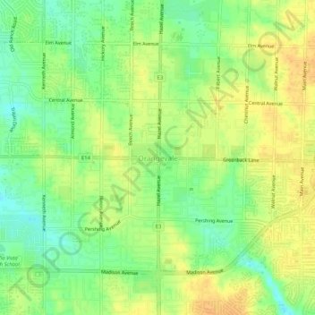
Name: Orangevale topographic map, elevation, terrain.
Location: Orangevale, Sacramento County, Californië, 95662, VS (38.65851 -121.24578 38.69851 -121.20578)
Average elevation: 74 m
Minimum elevation: 57 m
Maximum elevation: 87 m