
Thank you for supporting this site ❤️
Make a donation
Make a donation
Gear up for your next adventure:
As an Amazon Associate, this site earns from qualifying purchases at no extra cost to you.
Gatcombe topographic map
Click on the map to display elevation.
Thank you for supporting this site ❤️
Make a donation
Make a donation
Gear up for your next adventure:
As an Amazon Associate, this site earns from qualifying purchases at no extra cost to you.
About this map
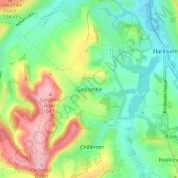
Name: Gatcombe topographic map, elevation, terrain.
Location: Gatcombe, Isle of Wight, England, PO30 3EG, United Kingdom (50.64550 -1.33180 50.68550 -1.29180)
Average elevation: 69 m
Minimum elevation: 14 m
Maximum elevation: 167 m
Thank you for supporting this site ❤️
Make a donation
Make a donation
Gear up for your next adventure:
As an Amazon Associate, this site earns from qualifying purchases at no extra cost to you.