
Itebero topographic map
Interactive map
Click on the map to display elevation.
About this map
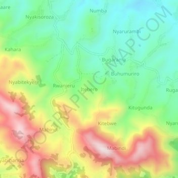
Name: Itebero topographic map, elevation, terrain.
Location: Itebero, Rukungiri, Western Region, Uganda (-0.99009 29.89051 -0.95009 29.93051)
Average elevation: 1,917 m
Minimum elevation: 1,705 m
Maximum elevation: 2,227 m