
Murs topographic map
Interactive map
Click on the map to display elevation.
About this map
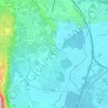
Name: Murs topographic map, elevation, terrain.
Average elevation: 288 m
Minimum elevation: 248 m
Maximum elevation: 521 m
Other topographic maps
Click on a map to view its topography, its elevation and its terrain.
Saint-André
France > Auvergne-Rhône-Alpes > Savoie > Porte-de-Savoie
Saint-André, Les Marches, Porte-de-Savoie, Chambéry, Savoie, Auvergne-Rhône-Alpes, France métropolitaine, 73800, France
Average elevation: 382 m