
Thank you for supporting this site ❤️
Make a donation
Make a donation
Gear up for your next adventure:
As an Amazon Associate, this site earns from qualifying purchases at no extra cost to you.
Majhakot topographic map
Click on the map to display elevation.
Thank you for supporting this site ❤️
Make a donation
Make a donation
Gear up for your next adventure:
As an Amazon Associate, this site earns from qualifying purchases at no extra cost to you.
About this map
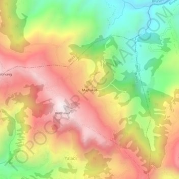
Name: Majhakot topographic map, elevation, terrain.
Location: Majhakot, Waling-03, Waling, Syangja, Gandaki Province, Nepal (27.98727 83.82535 28.02727 83.86535)
Average elevation: 1,178 m
Minimum elevation: 648 m
Maximum elevation: 1,677 m
Thank you for supporting this site ❤️
Make a donation
Make a donation
Gear up for your next adventure:
As an Amazon Associate, this site earns from qualifying purchases at no extra cost to you.