
Senglea topographic map
Interactive map
Click on the map to display elevation.
About this map
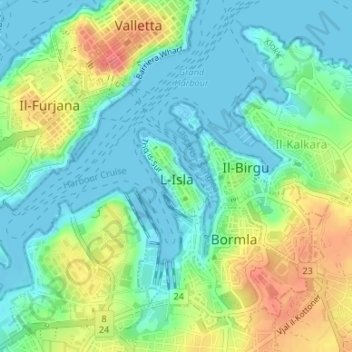
Name: Senglea topographic map, elevation, terrain.
Location: Senglea, South Eastern Region, Malta (35.88378 14.51356 35.89107 14.52019)
Average elevation: 23 m
Minimum elevation: -10 m
Maximum elevation: 67 m
Other topographic maps
Click on a map to view its topography, its elevation and its terrain.