Geolocate

保安湖 topographic map

Interactive map

Click on the map to display elevation.

About this map

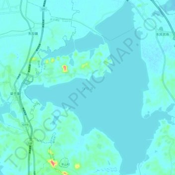
Name: 保安湖 topographic map, elevation, terrain.

Location: 保安湖, 黄石市, 湖北省, 435000, 中国 (30.19973 114.65304 30.30302 114.75699)

Average elevation: 20 m

Minimum elevation: 11 m

Maximum elevation: 106 m

Other topographic maps

Click on a map to view its topography, its elevation and its terrain.

磁湖

中国 > 湖北省 > 黄石市

磁湖, 西塞山区, 黄石市, 湖北省, 435000, 中国

Average elevation: 60 m

网湖

中国 > 湖北省 > 黄石市

网湖, 黄石市, 湖北省, 435000, 中国

Average elevation: 24 m

黄荆山脉

中国 > 湖北省 > 黄石市

黄荆山脉, 黄石市, 湖北省, 435000, 中国

Average elevation: 213 m

官桥村

中国 > 湖北省 > 黄石市

官桥村, 黄石市, 湖北省, 中国

Average elevation: 27 m

大冶湖

中国 > 湖北省 > 黄石市

大冶湖, 黄石市, 湖北省, 435000, 中国

Average elevation: 82 m