
Nospelt topographic map
Interactive map
Click on the map to display elevation.
About this map
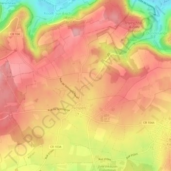
Name: Nospelt topographic map, elevation, terrain.
Location: Nospelt, Kehlen, Canton Capellen, Luxemburg (49.66352 5.98092 49.69399 6.03150)
Average elevation: 328 m
Minimum elevation: 242 m
Maximum elevation: 372 m