
Le Hockai topographic map
Interactive map
Click on the map to display elevation.
About this map
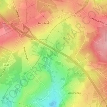
Name: Le Hockai topographic map, elevation, terrain.
Location: Le Hockai, Stavelot, Luik, Wallonië, 4970, België (50.47184 5.97678 50.47303 5.97726)
Average elevation: 520 m
Minimum elevation: 441 m
Maximum elevation: 577 m
Other topographic maps
Click on a map to view its topography, its elevation and its terrain.